Discover the enchanting Doi Khun Tan National Park, nestled in Amphoe Mae Tha, Thailand. This stunning destination is perfect for trekking, birdwatching, and exploring diverse wildlife while enjoying breathtaking scenery. Immerse yourself in a world of lush forests, vibrant flora, and panoramic views that make Doi Khun Tan a must-visit for nature enthusiasts.

Doi Khun Tan National Park is a hidden gem located in Amphoe Mae Tha, Thailand. Spanning over 200 square kilometers, the park is renowned for its stunning landscapes, diverse ecosystems, and a plethora of outdoor activities that attract nature lovers and adventure seekers alike. Nestled in the mountainous region, the park provides a serene escape from the bustling city life.
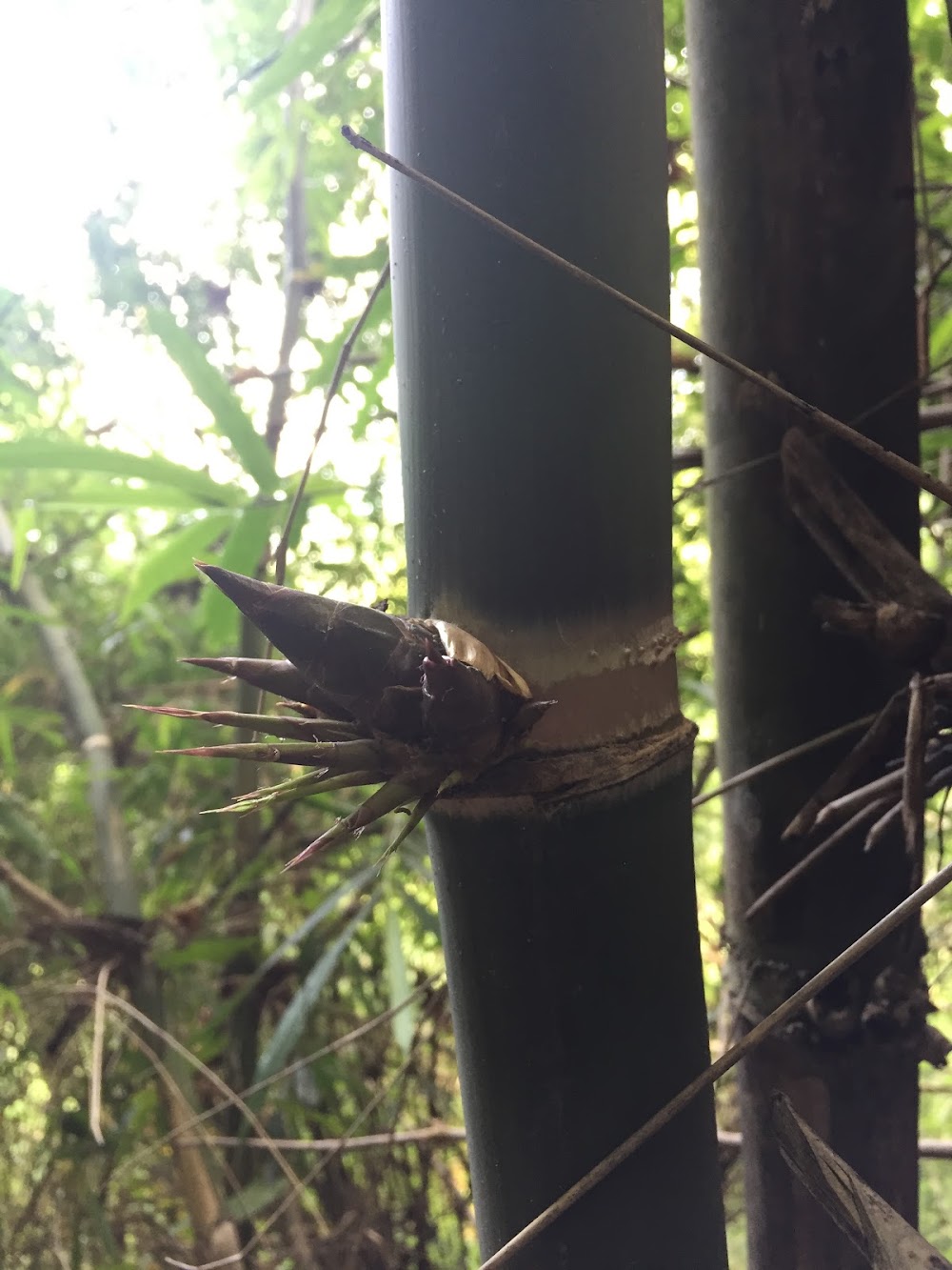
One of the main attractions of Doi Khun Tan National Park is its extensive network of hiking trails. These trails cater to various skill levels, allowing visitors to immerse themselves in the park’s natural beauty at their own pace. The trek to Doi Khun Tan, the highest peak, rewards hikers with breathtaking views of the surrounding valleys and forests. The lush greenery is home to a rich variety of flora, including rare species of orchids and towering trees, making every hike a unique experience.
The park is also a haven for birdwatchers. With over a hundred species of birds recorded, including several that are endemic to Thailand, birdwatching enthusiasts will find themselves in paradise. Early morning hikes are particularly rewarding, as the dawn chorus fills the air with melodious sounds, providing an unforgettable sensory experience.
Wildlife is abundant in Doi Khun Tan, with opportunities to spot gibbons, deer, and other creatures in their natural habitat. The tranquil environment allows visitors to connect with nature and appreciate the importance of conserving such beautiful landscapes.
For those interested in culture, the park is surrounded by small villages where visitors can learn about local traditions and customs. Engaging with the local community provides a deeper understanding of the region’s cultural heritage and strengthens the connection between the visitors and the land.
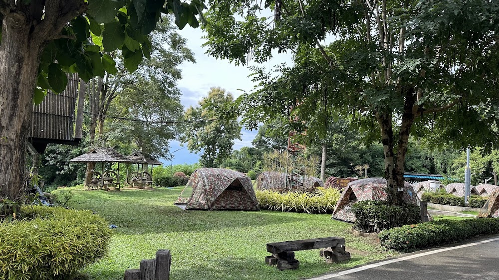
Accommodations near Doi Khun Tan National Park range from cozy guesthouses to camping facilities, allowing visitors to choose their preferred level of comfort. Staying overnight enables guests to experience the park’s tranquility after the day-trippers leave, offering a magical ambiance under the starry sky.
Doi Khun Tan National Park is an ideal destination year-round, with each season presenting its unique charm. Whether you’re hiking through vibrant greenery in the rainy season or experiencing the crisp air and colorful foliage during the cooler months, every visit promises awe-inspiring encounters with nature.
In summary, Doi Khun Tan National Park stands out as a prime destination for those seeking adventure, tranquility, and a deeper appreciation for Thailand’s natural beauty. Its well-preserved ecosystems, diverse wildlife, and stunning landscapes create an unforgettable experience for all who visit. Embrace the wonders of Doi Khun Tan, where nature and adventure intertwine harmoniously.
Doi Khun Tan National Park (แม่ทะ, ไทย) - รีวิว - ThailandAgoda.com
Attractions
6 miles
0.00 miles
0.52 miles
4.36 miles
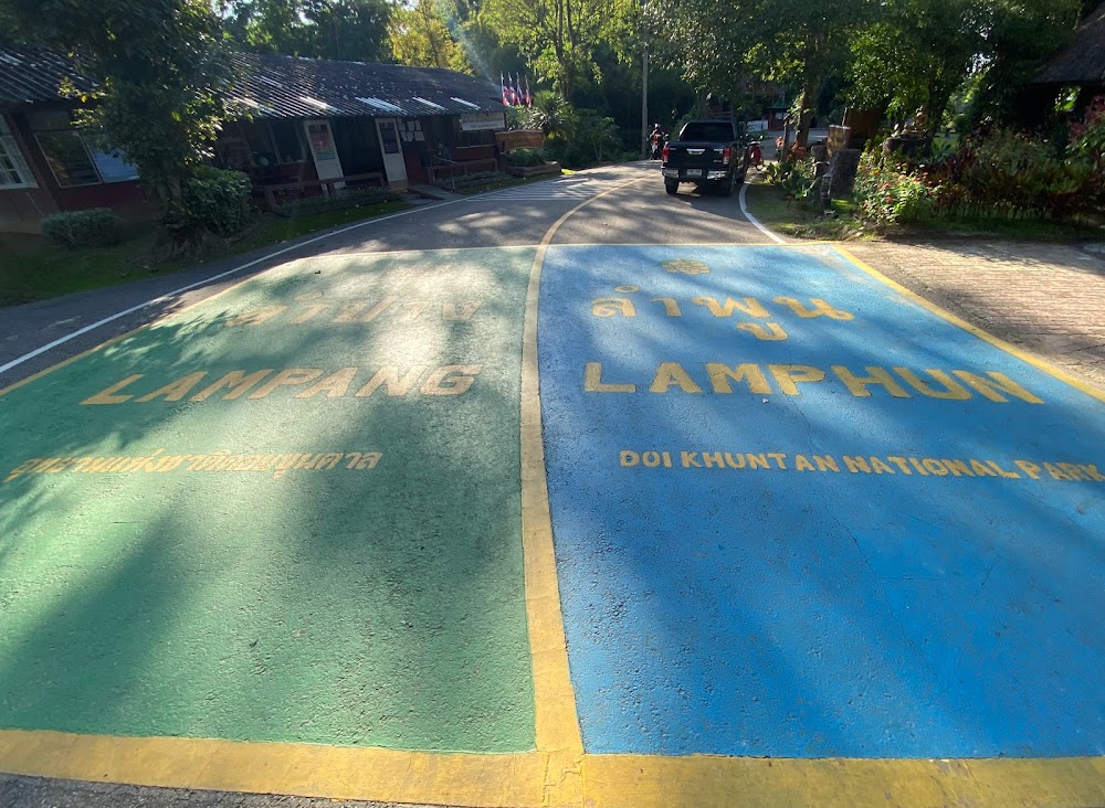
Doi Khun Tan National Park is perched on a picturesque hilltop overlooking Mu 8 Tambon Tha Pladuk, Amphoe Mae Tha, 51140, Thailand
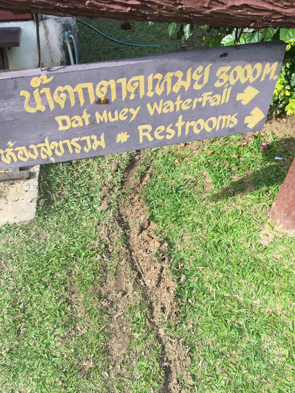
The experience of hiking in the quiet Doi Khun Tan National Park for a workout was great but the unexpected result of almost getting lost here prompts me to remind visitors NOT to go to or leave the peak via the route with waterfalls. Tired of meeting the crowds during the tours of white water rafting, elephant riding etc, we hired a taxi (1,800 baht incl gasoline) for a day trip to the park on 6 May. We were given a map which showed two routes going up the 1,300m+ peak. Strictly speaking it was not a map, just a rough plan of the routes which were not drawn in scale. But we didn’t question the accuracy as we didn’t think anyone can get it wrong with only two very clear routes here. One passes through clusters of bungalows (say route A) and the other through waterfalls (route B), each about 9km in length which meant the hike should be 18km long. We decided to take route A up because we planned to dip the falling water after hiking on a rather hot day.I guess there were only two of us visiting the park that day and we were so happy we occupied the ‘entire’ park by paying a few hundred bahts’ entrance fee. Everything went well and we took 3 hrs to get to the top. We left the peak with about 300-400ml of water. We were excited rushing downhill. However, after we had reached Tat Muey (or Tat Meoi) Waterfall, we couldn’t find any defined or ill-defined trails to continue our way back. We hiked incl bushwhacking several times a week in HK so we would easily identify there was any trace a trail, even if a bit bushy, existed. But no. Fallen trees, bamboos, rush have filled the area around the waterfall. Our search of an exit for almost 30 min ended in vain. I tried to make a roaming call to my taxi driver for rescue yet there was no phone reception. We yelled and heard only our echo as there were really only two of us in the mountains. We did consider moving to the west ‘at all odds’ (national park entrance ‘should be’ in the west according to the leaflet in hand) or climbing down along the rocky/bouldary river bank to look for our way. We dropped that idea eventually because it’s already 4ish and sun was setting soon; it’s very hard to move any 30m further but the national park entrance was 3-4km away; we would have no energy and run out of water if we failed to find our way and decided to turn back to the waterfalls; worse was if we got lost somewhere far away from the waterfalls, it would be difficult for the rescuers, if any, to locate us. Finally we made the hard decision – stop searching for route B. With about 200ml water and being very very tired and thirsty, we walked a few hundred metres up back to join route A again. We were lucky to get resupply of water from an old man in the midway. He may be the only one living in the park’s mountains (between Viewpoint 1 and Viewpoint 2). By around 6ish, we came returned to the park entrance and did a total distance of 21 km. We learnt that the park had sent 4 people to look for us on the trail. Losing contact with us worried them as visitors normally came back by 4pm.As the trail around Tat Muey Waterfall ‘disappeared’, it was dangerous for anyone to go there without preparation. We asked the staff of the visitor centre to check and scout the route and make sure it exists and seeable before the park management let people take the route via the waterfall.The taxi hire was assumed to last from 8am to 5pm. We didn’t get back to town until nearly 8pm. We paid an extra 400 baht as compensation for car waiting. Thank god we made it to catch our flight at 6am the following day.Having said that, I didn’t regret the escape from the overcrowded, popular tourist spots in other parts of Chiang Mai to the nature.Sorry for not being available to share our experience earlier as life is hectic in HK.
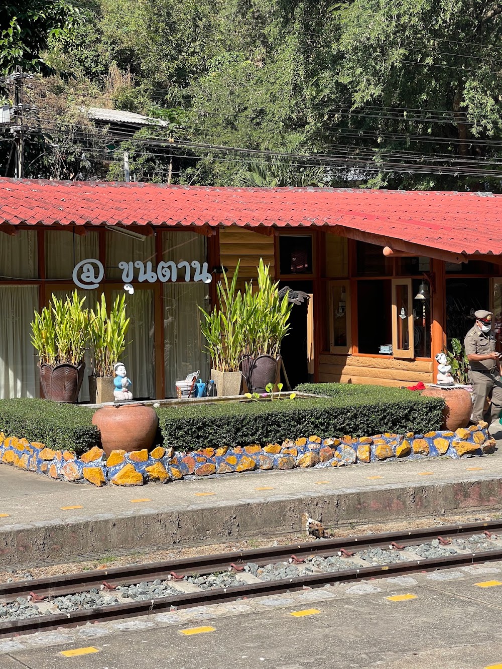
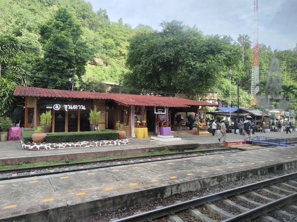
The access to the national park is direvt from the train station. For 15thb take the 9:30am train from Chiang Mai to Khun Tan. Then walk to the national park HQ. Walk-ins get 30% off on weekdays. A cute liitle bungalow is 350thb on weekdays and 500thb on weekends. Lots of history here plus about 15 km of hiking trails. All trains between Bangkok and Chiang Mai stop here.
So easy. Catch a train to Khun Tan station, then walk up the hill following the signs. Pay 100 baht to enter the park, then pop into the visitor centre to check in to a bungalow – basic but charming and very clean, with bedding, towels, hot showers and verandas. Eat at the restaurant for about 40 baht – but beware they only serve Thai food and close at 5. The shop is limited so bring provisions unless you don’t mind eating a lot of crisps and biscuits! We walked to the waterfall the day we arrived (not much water in Feb!) and to the summit of Doi Khun Tan the next day (wonderful but very hazy due to forest fires). We mostly had the place to ourselves. The park is meticulously maintained, and the staff are helpful and friendly. If you’re looking for an easy escape from the city, this one’s for you!
while the park is very easy to get to on the train and only a 20 minute walk up a steep hilm from the station you are at the gates. the park is not worth visiting for these reasons: you pay 100 baht each for entry and they give you a map with two route options, we were advised to take the second route with no reason why. there is a tarmac road most of the way up and the ‘nature trail’ just cuts off the corners with steep steps covered in moss! we found that most of the trail us over grown and yoj are unable to use it. due to this we ended up walking on the road alot and were hassled by packs of dogs. none of them hurt us however they were every threatening and we ended up getting a ranger to walk as part of the way down and keep the dogs back. we didnt even manage to get to the second point as there were dogs growling at us from the top of the path and we ended up giving up.on the way down we tried to find the first nature trail however this was completely over grown and impossile to get through no waterfall for us then! we stooped at the restaurant before we left which only served fried rice nothing else. not worth visiting and not worth 200 baht
A easy train trip to khun Tan station from Chiang Mai. The walk to the entrance is about 2 km up the path & Road. I hiked the summit as we were told there is no water at waterfalls. The park is clean well marked & with toilets and bins along the path. If you register at the information office and make it to the summit proof of phone pic you will get a certificate. I thoughtly enjoyed the park visiting it twice in 2 weeks.
We made the trip by road over the scenic winding 1229 road through the hills from Mae On, visiting a huge statue to a revered monk in the village of Ban Mae Takhrai, where the 1229 joins the 1230. The road down the valley through the fields to the park is extremely scenic, as is the road into the park and up to the summit. We followed the very scenic 5017 from the foot of the mountain through the hills to join route 11 south of Lampun, and thus completed the loop back to Chaing Mai. A great day out, with wonderful scenery along quiet roads through fields and forests
I did a day trip from Chiang Mai today to the summit of Khun Tan. It Is a great escape from the city. I caught the 8:50 train from Chiang Mai, and got up to the visitor center by about 10. The total hike me about five hours, and that was including the looploop to the waterfall. The hike up it was fantastic, I did it on my own and had no concerns and the view at the top is spectacular. The loop to the waterfall wasn’t worth it in my opinion, at this time of year the water wasn’t running very fast and it’s a lot of extra uphill and downhill. Overall it was a fantastic day from the city, I got the 18:20 train back to Chiang Mai and was back to my hostel by 8 PM
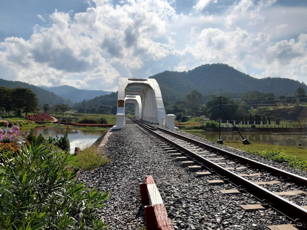
Having an interest in railways, the single line from Chiang Mai to the very pretty station at Khun Tan is an experience in itself. Several pretty local stations will be seen, most manicured by the Stationmaster and staff which is a reminder of how things used to be in the UK. The National Park is a short walk from the station at Khun Tan and the longest railway tunnel in Thailand. Amazing engineering set in a beautiful ‘jungle’ environment, so imagine the elephants, bears and tigers that once roamed free here. Fascinating.
The accessibility of the park by train is a big plus. No need for expensive taxi service or time-consuming bus changes. The hike was not touristy, but well traced and very enjoyable. The summit at the top offers a nice view and was very rewarding.We took the 10 a.m. train from Lampang and arrived in the cute little station of Khun Tan at 11 a.m. You can leave your backpack at the station. From the station to the park’s entrance, count 20 minutes by foot. At the time of visit (dec.2019), the entrance to the park was 100 baht. The visitor center at the entrance provides a free map of the park. There’s also a small restaurant and a shop selling water bottles, among other things. There was only one trail, going to the summit. The other trail (towards the waterfall) seems to be closed since quite a while. The first part of the trail (from the visitor center to camp 1 (“yom 1”) lasts about 2km and is partly on the road. There are shortcuts cutting the road’s hairpins. At camp 1, names and phone numbers (in case of emergency) are written down in a register. Looking at the register, I could see that only 14 persons were taking the hike the same day as myself. Although it was high season, Doi Khun Tan was not touristy at all. It took approx. 2h00 to cover the 5km from camp 1 to the summit. Adding the time needed to go from the train station to camp 1 (through the visitor center), I believe 2h30 at a “normal” pace is a realistic estimation to reach the summit.To go back down, two hours will suffice.The trail is very well marked and easy to follow. No crossings, no confusion possible : it’s all very straigt-forward. In december, the trail could be done without specific hiking shoes. In the wet season, this might be different. A train leaves Khun Tan at 18h23 to reach Chiang Mai at 19h30. Check Thai Royal Rail to check timetable changes. All in all, a highly recommendable day hike.